MountainBikeTx.com
Caprock Canyons State Park Trailway
South Plains, TX
Click here for help on how to read this trail guide
Directions:
Length:
Technical Level:
Trail Type:
Configuration:
Trail Map(s):
Fee:
Trails:
Amenities:
Links:
Contact:
Comments:
Photos:
Video:
Trail Review:
64 miles (one way)
1-2
Rails-to-Trails
out and back
$3 per person 13 and older/day use (annual pass available for $70)
Grundy Canyon Trail
| Kent Creek Trail | Oxbow Trail
Los Lingos Trail | Plains Junction Trail | Quitaque
Canyon Trail
none
(806) 455-1492
The Caprock Canyons Trailway is a 64-mile section of former railbed that stretches from the top of the Caprock escarpment in the Panhandle to the Red River Valley. ~TPWD
![]()
unavailable
Leaving Floydada, Texas
and realizing it is the biggest town you'll see for the rest of the
day makes you feel like you have finally found the REAL Texas.
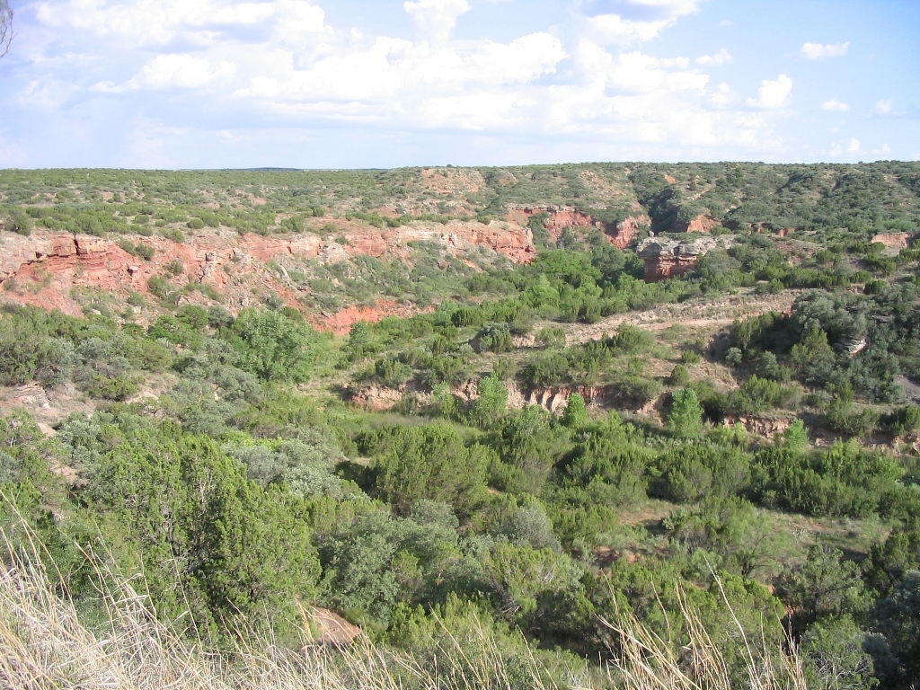
And you have. Farms and ranches dominate the view; 360 degrees, 100
miles. Seems like a strange place for getting a great ride in, but it
gets better.
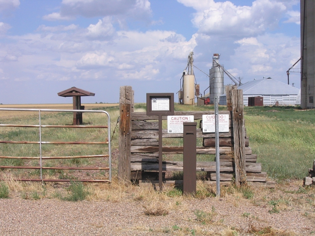
Park at the marked lot on the east side of Hwy 207 and slip your dollar bills
in the paybox. Double check you've got the slime-filled tubes, water,
cell phone, and camera.
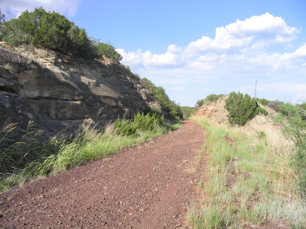
First two miles are grassy rails-to-trail gravel through local farms. Wave
to the farmers and they wave right back. Your car is perfectly safe
around these parts. You'll cross a few wooden bridges over crevices
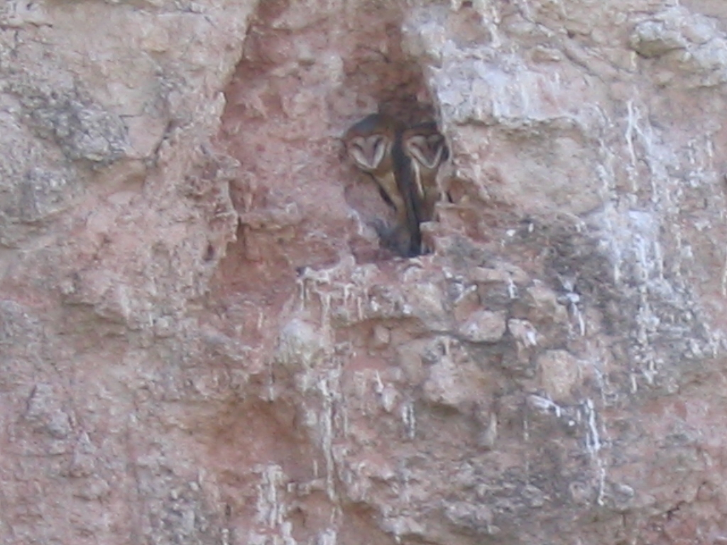
that hint at the canyonland ahead. After the third or fourth bridge,
keep an eye out on the left for a nest of barn owls in the soft canyon
walls.
You'll see state-maintained water tanks to refill your bottles. Check to
see that there's some in there on your way down.
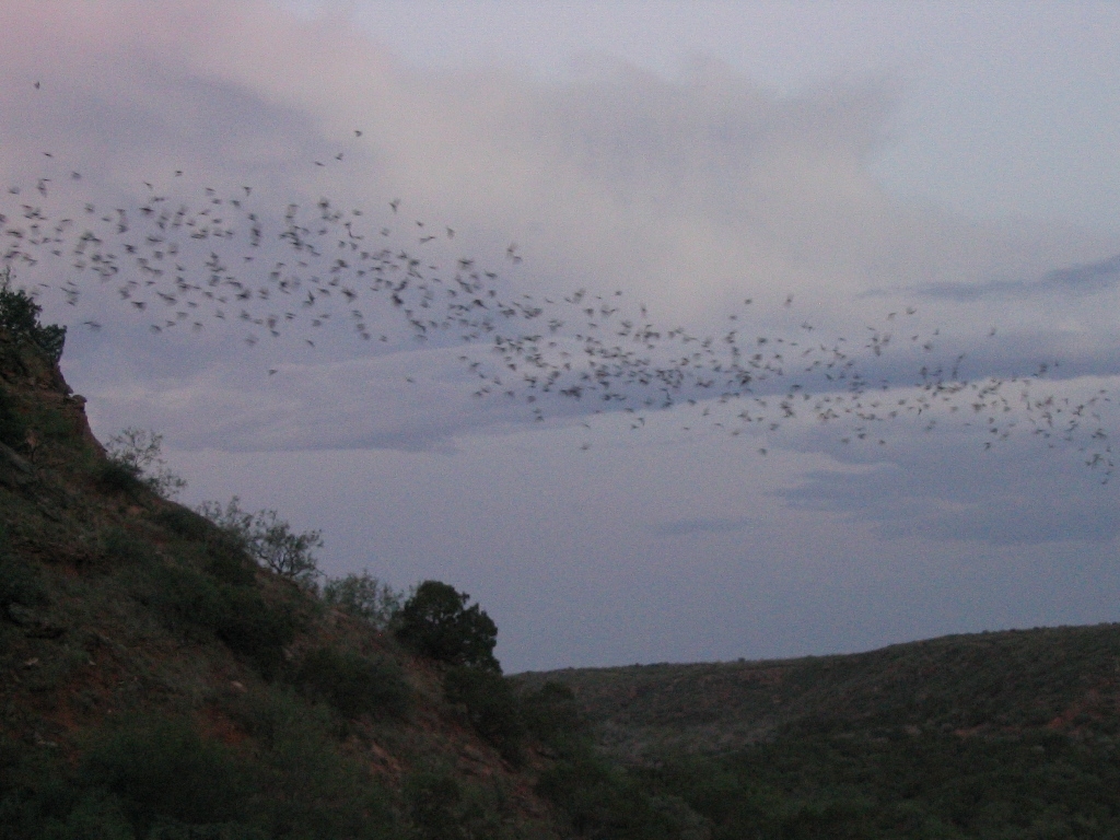
Best ride is the slightly downhill grade from the place marker in South Plains
12 miles to the Clarity Tunnel to camp. On summer nights hundreds of
thousands of bats fly out looking for supper. Owls are perched at the
tunnel mouth and will swoop down, pluck a bat from the sky, take it
to the nest, and come back to do it over and over. If you listen closely
you can hear the pitter-patter of guano as it hits the tent in the morning.
Scenery past the tunnel is sparse. You'll pass Quitaque (Kitt-a-kway) and
Turkey (home of Bob Wills and nice lodging) but it's all flat from here
to the end. Either of these towns makes a nice "take out point" or a
spot to refuel and head back up the grade to South Plains.
~ CRXPilot (Apr 2009)